 Mount Sneffels (14,153 ft), Ouray, Colorado
Mount Sneffels (14,153 ft), Ouray, Colorado
 |
Journal of a Mad Hiker (Part 1)
(4 Days, 6 Peaks, 40 Miles, 16,000 Vertical Feet)
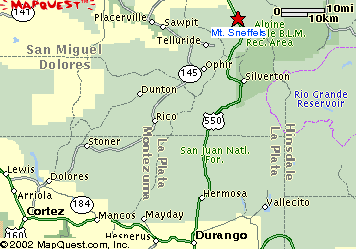
| Hike Stats | Date: June 18, 2002 | |
| Mount Sneffels: 14,153 feet | Base: ~9,500 feet | Vertical Rise: ~4,653 feet |
| Start: 07:45 | Summit: 11:00 | Return: 14:30 |
| RT Dist: ~11 miles | Conditions: sunny & clear | |
Mount Sneffels is very popular with guests in the Telluride / Ouray area, and for good reason. It is a truly beautiful peak in the San Juan mountains. Its sharp peak juts above the rest of the mountains in the area and offers an impressive view of the San Juan range. Besides, I think the name "Sneffels" is just too darned cute and is probably one of the reasons why it's so popular.
The book (you'll hear me refer to "the book" in these pages, and I'm referring to Dawson's Guide) says that no one is sure where the name Sneffels came from. There are many possible explanations ranging from the "sniffles" that the miners used to get up here, to Mt. Snaefell from a Jules Verne book, to a Nordic word for snow field. No matter how it got its name, I think this was a pretty good hike. I decided to hike it because some of my friends have talked about it, and it was on the way to Elbert. I was going to use it as a warm-up. Little did I know...
The Camp Bird Mine Road leading into Yankee Boy Basin (the start of the Sneffels Trail) proved to be a little too challenging for my poor Chevy Prizm. After gingerly coaxing the subcompact over what seemed like wagonwheel ruts for 7 miles (and bottoming out numerous times), I decided to leave the car at the Atlas Campground and start the hike there. This is a picture of what I presume to be the abandoned Atlas Mine because it sits squarely above the Atlas Campground.
BTW, starting here made my hike an 11-mile roundtrip instead of the 4 promised by the book, and it probably added another 1,500 feet or so of elevation. No matter, I was here to hike anyway. The only concern I had was that I had planned to do an easy hike on my first day to get acclimated to the altitude and then tackle a longer hike the next day. Oh well, nothing like the sink-or-swim strategy, right?
 |
I hiked along the 4WD road into Yankee Boy Basin. The sun was bright and the temperature was perfect (~65 degrees). What a beautiful day for a hike! I definitely felt the thinner air up here though, as I'm used to hiking Camelback "Mountain" in Phoenix with a daunting elevation of 2,708 ft! Soon though, I got used to the heavier and more mechanical breathing and found my "zone". I plodded along happily and enjoyed the view.
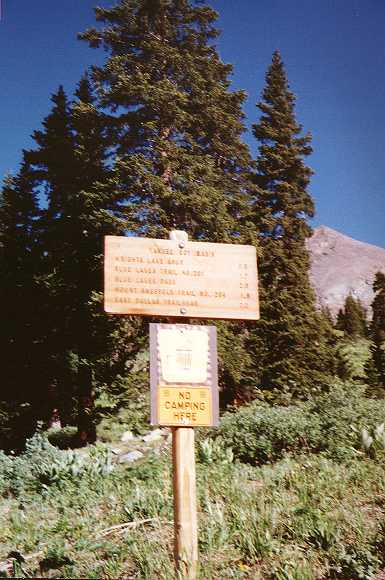
A bit farther up the road, I see the first marker. "Mount Sneffels Trail No. 204 -- 1.8" it says. OK, bring it on! I guess this also marks the entrance into Yankee Boy Basin, so I was happy to make a mental note of the "you are here" spot on my handy topo map copied out of the book. The elevation here is about 10,720 feet.
 |
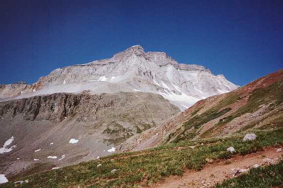
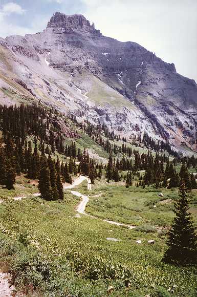
On the west side of the trail lies the imposing Chipeta Peak (12,698 ft). There is still some snow left, but the dry winter this year made summer hiking conditions ideal. Now you might think 12,698 is pretty high, and you'd be right. But today, I have my sights set a little higher! So onward I go.
 |
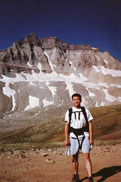
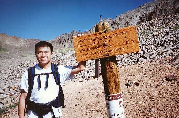
As I hike along the 4WD road, several Jeeps and SUVs passed me. Not a lot of traffic though, which is nice. I was tempted to hitch a ride to the trailhead, but resisted the urge. Afterall, I'm here for the hiking. I finally reach the trailhead at the end of the 4WD road. Here I ran into the first hikers, a young couple named Annie and Jared. So I asked one of them to snap a photo of me against Chipeta Peak.
One drawback to hiking solo is the lack of a designated photographer. I didn't want to do the hold-your-camera-as-far-as-you-can-and-snap technique of taking a photo of myself, so I'm reliant on passers by to do the honors. Fortunately, everyone I asked was gracious enough to oblige, in exchange for taking a group photo of their party of course.
 |
Another shot of me at the Sneffels trailhead. Though it might not look like it, the top of Sneffels is just to the right of the nail on top of the post.
 |
I was glad to have some company along on the hike because I had seen no other hikers this morning. It was serene, but a little eerie being in such a huge open place and not having another person around save for the occasional passing Jeep along the road below. It turns out that Jared works for a company that runs a series of huts along the San Juan range, and he was explaining to me how you can hike from hut to hut and spend the better part of a week in these hills. That sounds way cool! Mental note to come back and do that some day.
This is a picture of me against some sharp spire-like rocks that I thought were quite unique. The peak of Mt. Sneffels is on the right. Here the trail takes a sharp turn and heads up the scree bed you see behind me.
 |
Scree. I HATE scree! Hiking in this stuff is like trying to walk when you're drunk. You take one step forward and slide two steps back down the hill. It takes so much energy out of you because you can't just plant your feet as you step. You have to gauge how much weight the rocks will support before they give. So you end up gradually increasing the pressure on each step as you walk and expend an enormous effort on keeping your balance and trying not to twist your ankles when the rocks inevitably do give way.
BTW, photos absolutely kill the sense of perspective and depth. This incline is a lot steeper than it looks in this picture. At the top of this scree bed is the Lavendar Col, elevation 13,500 feet.
 |
Once you reach Lavendar Col, the trail turns left and heads up a boulder field in a steep and narrow couloir toward the summit. What a relief! No more scree. I prefer boulder hopping to sliding on a talus any day.
You might think at this point that I'm using a bunch of hiking terms just to impress you. Well, you'd be right! I didn't know what half these words meant a few months ago either and had to resort to a dictionary to look them up. A "talus" is a slope formed by accumulation of loose rocks (a.k.a. "scree"); a "col" is a saddle formation along a mountainous ridge; and a "couloir" is a narrow gorge on a mountain side.
At the top of this couloir, the trail just disappeared and the only thing facing me is a steep snow-covered drop into an abyss. Since I was pretty sure that I haven't reached summit yet, I just headed up the only way I could -- hand-and-foot scrambling over some pretty precipitous rocks. It wasn't technical climbing but I sure developed some white knuckles since it was a long long way to the bottom of that hill.
 |
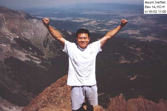
Victory at last! It wasn't too far after scrambling over those rocks at the top of the couloir that I found the summit and the only other hiking party I saw on the way up that day. There were a group of 4 perched at the peak taking some photos and having a snack. So guess what I did ... yup, asked for the favor of a photo.
This is the classic victory pose atop a high peak, a tradition that Scott and I started after our first hike up Humphreys and Pikes Peak. The weather was still very good with the temperature probably around 60 degrees. Thinking back, I should have read the little thermometer / compass that's permanently afixed to my backpack to record the temperature. Oh well, you get the idea from my t-shirt and shorts.
 |
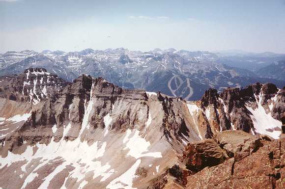
A view from the top. Looking to the southwest, you can see the ski runs from Telluride and the majestic San Juan mountain range.
 |
Coming down the mountain is generally much less strenuous than going up, especially at that altitude. Fortunately, I found where I had gone wrong at the top of the couloir and avoided down-climbing those rocks. Descending the scree bed was something else though! It was like surfing the mountain for 2,000 feet. Nasty!
With the worst parts behind me, I get to take all the "scenic" photos. This is a shot down the 4WD road and Yankee Boy Basin with some unnamed peak in the distance.
 |
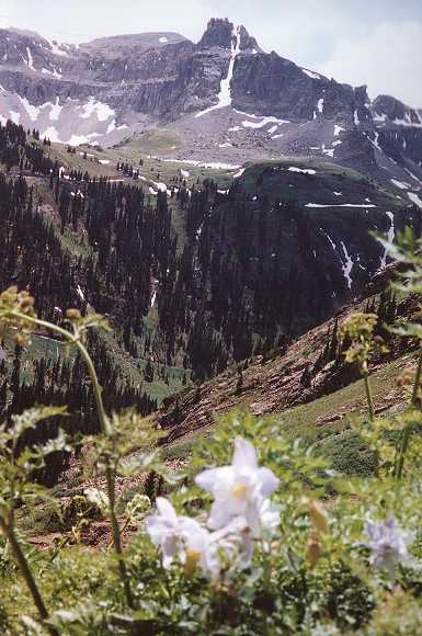
This is another shot to the opposite side of the basin. A couple of columbine flowers bloom in the foreground.
 |
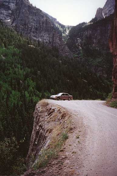
I was pretty impressed that my little car made it up and down that treacherous road. And the most amazing part of it is my CD changer didn't even skip while the car bounced up and down like a slinky on a staircase! Here's a scenic shot of a hairpin turn on Camp Bird Mine Road with my chariot parked near the edge.
 |
The best part of the hike? I would have to say it was the dip in the Ouray Hot Springs Pool after I got back to town. Soaking my sore body in that heavenly 106-degree spring water was absolutely divine! It was like feeling all your troubles mental and physical just drain out of every pore on your skin, and letting the heat penetrate deep into your muscles and bones. What a wonderful way to end a perfect day!
This is a shot I took just outside the Hot Springs looking toward Ouray and the mountains to the south. Next, a 3-hour drive to Leadville and Mount Elbert. I'm recharged and ready to go!
 |
| Prev | Next | Index |