 Humphreys Peak (12,637 ft), Flagstaff, Arizona
Humphreys Peak (12,637 ft), Flagstaff, Arizona
 |
| Hike Stats | Date: Various | |
| Humphreys Peak: 12,637 feet | Base: 9,320 feet | Vertical Rise: 3,317 feet |
| RT Dist: ~9 miles | Conditions: great trail, watch for lightning at top | |
Humphreys Peak, the tallest point in Arizona, is located near the town of Flagstaff in northern Arizona. It's a part of the San Francisco Peaks (Humphreys, Agassiz, and Fremont) formed by the violent explosion of a now-extinct volcano. 17th-century Spanish missionaries named these peaks after the founder of their Oraibi order, St. Francis of Assisi. Humphreys Peak, however, was named much later in the 19th century after Andrew Humphreys, a railroad surveyor. The elevation at the peak is 12,637 feet, despite many sources (some even reputable) who claim it's 12,643. I've even seen 12,670! Come on folks! It's not THAT difficult these days.
Humphreys is probably the easiest high-point hike of all the western states. Although I've hiked only one other (Elbert in Colorado), I've heard the travails of those who hiked Whitney in California, Kings in Utah, or Gannett in Wyoming. Hood in Oregon and Ranier in Washington are notorious for being difficult and dangerous. Having climbed Humphreys on numerous occasions, I can honestly say it is merely a practice hike for its bigger cousins.
With that said, Humphreys is not to be taken too lightly. It is still tall enough to poke through tree line, and has all the weather dangers that go along with alpine hiking. The winds see little resistance across the high plateaus surrounding the peak, and routinely exceed 60 mph at the top. Summer time thunderstorms are very unpredictable, and snow storms can occur any time of the year. The best time to go is mid June when the snow has melted away and the summer monsoons have not yet started to brew.
There are several trails that can get you to the top. The most popular begins in the parking lot of the Arizona Snow Bowl ski resort at an elevation of around 9,300 feet. This trail traverses a meadow (which doubles as the bunny hill of the ski area in the winter), dives into a dense forest, and snakes its way upwards. Along the 9-mile roundtrip hike, you'll cross a couple of avalanche rock fields, some nice switchbacks in the shady cool forest, the only tundra found in Arizona (complete with its own endangered plant species -- the senecio franciscanus -- found no where else in the world), plenty of volcanic rock, and no less than three discouraging false peaks! The views are spectacular from the peak. On a clear day you have over 100 miles of visibility and can see the Grand Canyon, the Painted Desert, Oak Creek Canyon, and Meteor Crater.
Our trips usually involve camping overnight in the Kachina Wilderness Area near the ski resort to get acclimated to the altitude. The next morning, we pack up our stuff and hit the trail no later than 8 am, lunch at the saddle point between Humphreys and Agassiz peaks, and return in time for a nice dinner in Flagstaff. These pictures were taken over the course of several trips to Humphreys, so don't be surprised to see different people and varied settings.
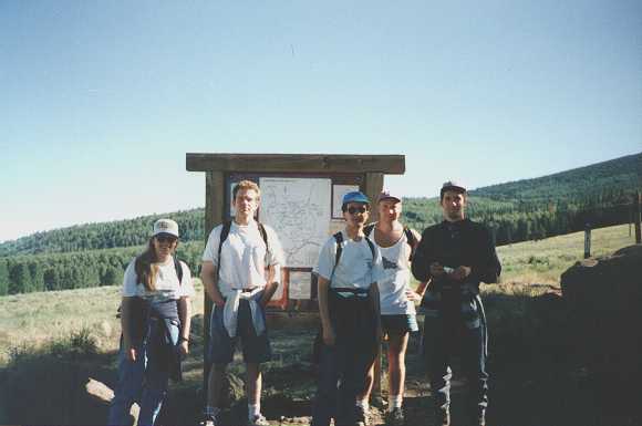
A bunch of us gather for a group photo at the trailhead. From left to right you have Michelle, Byron, Gerhardt, Scott, and Robert.
 |
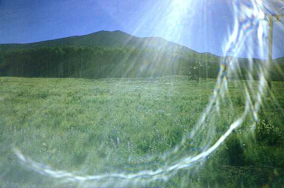
This a cool picture of the San Francisco Peaks looming above the Kachina Wilderness and the meadow / bunny hill. You can see the Snow Bowl chair lifts in the right half of the picture. The bright sun casts its glaring light down on the purple wildflowers that dot the beautiful green meadow.
 |
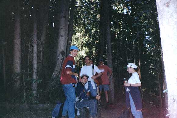
Deep inside the forest, the crew takes its first break.
 |
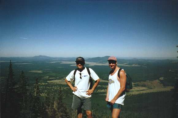
Scott and I pose for a picture as we come across a clearing. The wide expanse of northern Arizona plateaus stretch out as far as the eye can see in the background.
 |
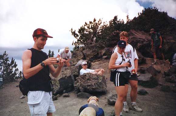
This is our typical picnic lunch spot -- the saddle point between Humphreys and Agassiz. The elevation here is 11,800 feet, just below tree line. In the picture you have Robert, Scott, John, Tina (one of my coworkers visiting from Detroit), and her fiancé Ryan. The dog and other guy on the right were with another party. Say... can I put my pack on the dog too?
 |
Above the saddle, the going gets tough. The trail degenerates quickly from packed earth to loose expanses of dark volcanic rock. The trail runs along the top of the ridge, so hikers are exposed to the elements with no protection from sun, wind, rain, lightning, or snow. The Arizona sun can be twice as deadly up here since the air is thin and the rays are strong. Byron seems to have found a comfortable resting spot near the trail and decided to take a quick nap.
 |
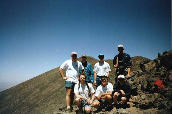
Walking along the ridge above the saddle point, you are greeted with no less than three false peaks. At this vantage point, you can see a couple of them. In the photo we have (clockwise from top left) Scott, Greg, Gerhardt, Robert, Michelle, me, and Byron. A sudden gust of the famous wind up here claimed my favorite hat and sent it about 1,000 feet down the hill. Now I'm not one to litter on hikes, but there's no way I was going after that hat!
 |
In an illustration of the weather dangers at the top of Humphreys, here are Scott and I doing the victory pose with some SERIOUS storm clouds above us. The plaque in front of us denotes the tallest point in Arizona at 12,633 feet (now listed by the USGS at 12,637 feet). A makeshift summit log is kept in a tin box next to the sorry excuse of a wind shelter at the peak. In the shelter we saw this lady with her hair standing straight up from the electricity charged air! Soon after this picture, we made a mad dash for tree cover in order to escape the encroaching lightning strikes.
FYI, on this particular day we encountered sun, clouds, wind, rain, hail, sleet, and lightning so close we can see it land on the next hill over. Pretty impressive to have gone through all those weather phenomena in the same day! And pretty lucky to have come out of it unharmed!
 |
| Next | Index |