 1-Day Grand Canyon Hike (November 2, 2002)
1-Day Grand Canyon Hike (November 2, 2002)
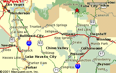 |
I've always wondered if the Grand Canyon can be done in a day from Phoenix. If you're like me, you've pretty much exhausted the day hikes in the metro Phoenix area. One day in early November of 2002, I grabbed my friend Mandar and decided to drive up to the Grand Canyon, hike it, and return to Phoenix on the same day. This is the story of that hike.
The logistics of the trip were much simpler, and it didn't require much planning. That's what I love about day hikes. I can just decide on a whim to go the next morning. However, the 3.5 hours it takes to drive there from Phoenix proved to be a worthy obstacle. We left promptly at 5 am, and our plan was to hit the trail by 9 am. Unfortunately we were trapped on the canyon shuttle system for about 45 minutes and weren't able to start until close to 10 am.
The favorable weather (as it turns out) more than made up for the slow start. We saw ideal temperatures at the bottom (70-75 degrees), and it was even a bit chilly when we arrived at the top in the late afternoon. This is about 30 degrees lower than what we usually see in mid May, and it took quite a bit off our hiking times. We were able to emerge from the depths of the canyon well before sundown.
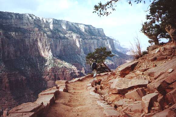
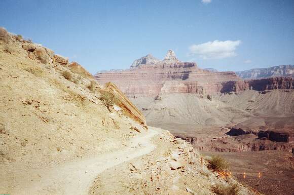
After some bus-hopping, waiting, and numerous long bus stops, we finally arrived at the South Kaibab trailhead. Descending briskly, we try to cover some ground fast. Mandar speeds ahead down the South Kaibab Trail. I must have pointed the camera down a bit since it looks like we're going up instead of down here.
 |
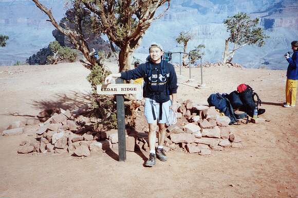
Cedar Ridge is usually a good place for a photograph and water break. It's also a good place to shed some outer layers.
 |
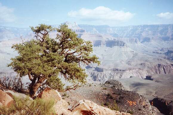
One of the last evergreens along the trail frames the distant undulations and shadows of the grand canyon.
 |
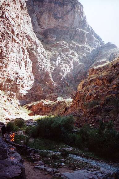
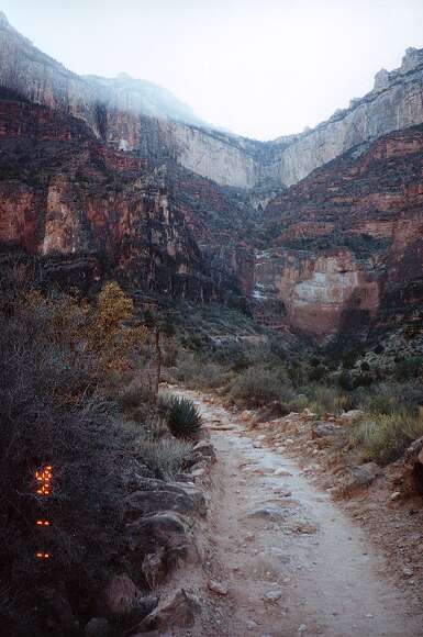
Zoroaster Temple is perhaps the most notable landmark in the Canyon. Here it pops into view as the trail takes a bend.
 |
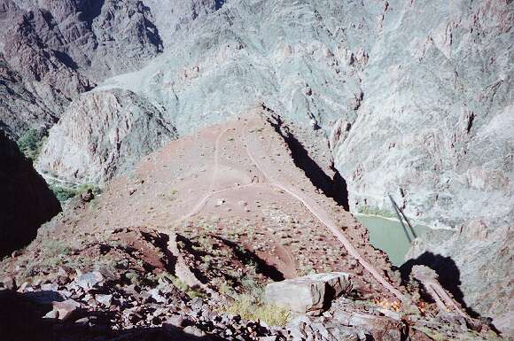
We quickly drop down toward Panorama Point. From there, you can see a good section of the river, and the surrounding canyonscape. The bridge to its right is the Black Bridge, and marks the bottom of the canyon.
 |
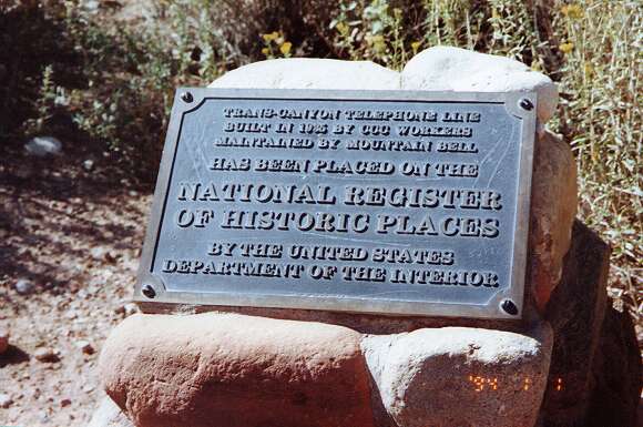
We made great time, and hit rock bottom in just over 2 hours. This plaque is near Phantom Ranch and explains some details about the trans-canyon phone line.
 |
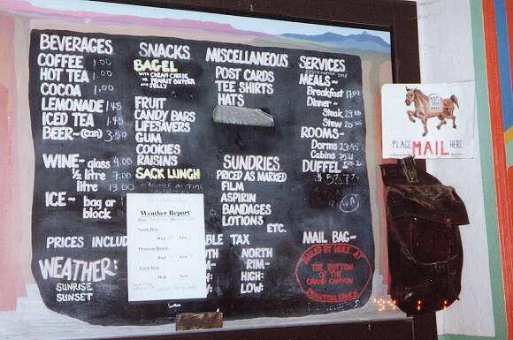
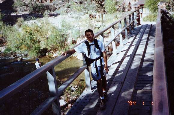
Mandar had not been to the Phantom Ranch before, so we decided to take the short detour to render a visit. One prominent feature of the canteena at Phantom Ranch is the fact that you can send a postcard from here delivered by mule train to anywhere in the world. Mandar decided to send a couple of them to India (amazingly enough they are 60 cents each -- I love the postal service). The mailbox at the canteen is the leather bag you see on the right side of the picture. By the way, the photo is not taken on Jan 1, 1994. My camera battery died, and I just forgot to reset the date indicator.
 |
A shady character on the bridge across Bright Angel Creek. We took about 45 minutes to check out Phantom Ranch and rest. Now we are on our way up the Bright Angel Trail.
 |
After leaving the river, Mandar and I split up and I went ahead. We had (for the first time) a couple of FRS radios so we could still communicate. This photo was taken just before a section of switchbacks called the Devil's Corkscrew.
 |
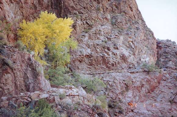
Normally when we ascend the Devil's Corkscrew, the sun would be beating down upon us and we'd be dying for a patch of shade. This is the only shade tree along that stretch, and I've named it the Tree of Life because it has saved us many times in the past. This time, we are fortunate to catch the beautiful cottonwood with golden autumn leaves.
 |
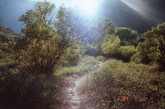
The sun sets a lot earlier in November! As we are nearing Indian Garden, the low-hanging sun casts its rays through many golden leaves. The cool temperatures make a huge difference in the general welfare of the canyon hiker. I felt strong the whole way and didn't stop between the river and Indian Garden. This part of the trip took 1.5 hours, an impressive 3-mph clip on an uphill. Mandar came into Indian Garden only a few minutes later.
 |
After a brief rest, we started the final ascent toward the top. You can see that the sun has sunk down quite a bit, and we'd be in shade the whole way up. Normally (as in if we are doing this in May like my other trips) this would be a blessing, but in early November, we knew it'd be chilly as we neared the rim.
 |
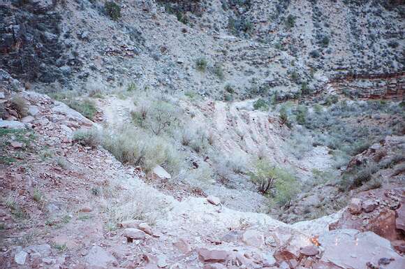
The Bright Angel Trail goes up the canyon wall in a series of tight switchbacks. Here you can see some of them spiralling up and down.
 |
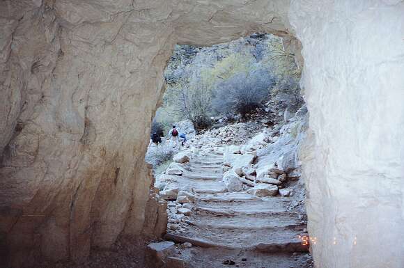
This is a picture of the first arch we go through on our way up. There's only about a mile to go. The wind has picked up and the air cooled down considerably. At this point I realized the one essential item I forgot to pack, gloves. My fingers were completely numb from the cold. The rest of me was fine in T-shirt and shorts, but my hands were cold. I pulled out my windbreaker jacket, but it didn't help the hands.
 |
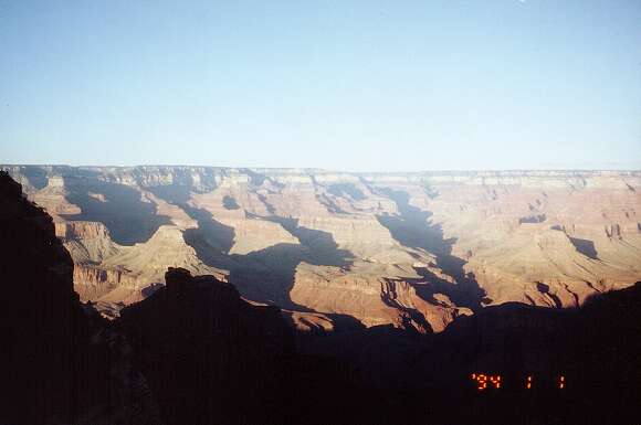
The wind is howling now and I can feel it press the cool windbreaker against my chest and arm. My hands had no feeling at all by now, but I was glad that I made it to the top without stopping from Indian Garden. It took about an hour and forty five minutes, just a shade under 3-mph pace for the steepest part of the hike. Not bad I thought. We even beat the sunset! This shot was taken around 5 pm when I reached the top.
After a hot shower to warm ourselves, Mandar and I hopped into my little car and drove straight back to Phoenix. We came back into town around 9:30 pm -- mission accomplished! We did the canyon as a day hike from Phoenix.
 |
| Prev | Next | Index |