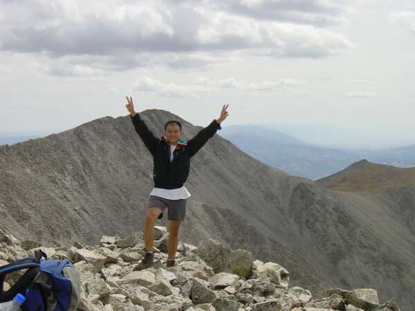
 Mount Shavano (14,231 ft) and Tabeguache Peak (14,162 ft), Poncha Springs, Colorado
Mount Shavano (14,231 ft) and Tabeguache Peak (14,162 ft), Poncha Springs, Colorado
 |
Journal of a Mad Hiker (Part 2)
(6 Days, 10 Peaks, 56 Miles, 25,910 Vertical Feet)
| Hike Stats | Date: September 1, 2002 | |
| Mount Shavano: 14,231 feet | Base: 9,880 feet | Vertical Rise: 4,351 feet |
| Start: 08:00 | Summit: 11:00 | Return: 15:00 |
| Tabeguache Peak: 14,162 feet | Base: RT from Shavano | Vertical Rise: ~1,000 feet |
| Start: 11:30 | Summit: 12:15 | Return: 13:30 |
| RT Dist: ~10 miles | Conditions: sunny with afternoon clouds | |
The morning of September 1, I embarked on my week-long quest starting with Mount Shavano (pronounced SHA-ve-no) and Tabeguache Peak (officially TAYB-watch, or more commonly TUB-a-wash), a week that would include 55 miles on foot and 25,000 feet of elevation gain. Mount Shavano sits at the southern tip of the Sawatch mountain range, a range that has 15 peaks over 14,000 feet. As a matter of fact, there's a race called Nolan's 14 in which crazed participants run 14 of these peaks on foot in 60 hours. The name of the mountain range comes from the Ute word saguache (sa-WATCH) meaning a blue-green color.
A mile-long high ridge connects Mount Shavano and Tabeguache Peak, making it possible to bag both peaks in one day. Tabeguache got its name from a band of Ute Indians, the oldest known residents of Colorado (which the US government unceremoniously relocated to a reservation in Utah during 1881). The current spelling derives from a word coined by the explorer Escalante in 1776 meaning "place where the snow melts first". Shavano was the name of Ouray's (a famous Ute chief) second-in-command war chief. The word Shavano means "blue flower", but was derived from Spanish rather than Ute.
More interesting than the etymology of Shavano is the legend surrounding the angel snowfield. Every spring, the snow in the southeast couloir of Mount Shavano forms the shape of an angel. Thus a local legend developed around it. I don't have space here for the entire legend, but the gist of it is that the gods turned a mischievous girl into ice, and she repented by sacrificing herself to feed the people and lands below with water as she melted every spring. The Chaffee County sheriff's department offers the best and most romantic account of the Angel of Shavano legend (it's worth reading).
Anyway, enough about the mystic stories. I came here to hike. The Angel of Shavano Trail began at the Blank Gulch Trailhead, a 10-mile drive on rocky dirt roads from the town of Poncha Springs. My low-slung subcompact bounced and rattled down the road surprisingly well, and I found my way to the trailhead around 8 am. The trail snakes up in a steady and steep angle about 4 miles to the summit of Shavano. From there, you can traverse the fairly easy ridge to Tabeguache and back. Not bad for the first hike on the trip. It was a great start to a fabulous week of hiking, as you'll see in this and the following pages.
Oh by the way, I forgot to mention that this trip was the first time I've used a digital camera to capture the scenery. My friend John was gracious enough to offer his Sony DSC-P1 3.3 megapixel camera, and I made full use of it. Most photos were taken at 2048x1536 resolution and post processed down to 600x450 for easy downloading.
A distant view of Mount Shavano from US Hwy 50.
 |
Early morning at the trailhead. The parking lot is already full of vehicles.
 |
The Angel of Shavano Trail shares a portion with the Colorado Trail, a system of trails that run hundreds of miles through central Colorado. This is a sign at the beginning of the hike.
 |
Here I am sporting the latest hiking fashion. T-shirt and shorts, my newly acquired backpack with chest and waist straps. Clip on camera case, and a 1.5 liter water bottle in one hand.
 |
The hike starts through densely grown forest, although the trees are a little barren near the base.
 |
Ah, this is more like it. Into a deep green forest.
 |
The first clearing of the day. I'm getting close to treeline. Can you tell this is my first day with the camera? I took so many pictures today...
 |
This is a view toward the south / southeast from the Angel of Shavano trail.
 |
Straddling the trail with one of the subpeaks behind me. This is near tree line (about 12,000 feet elevation).
 |
A closer look at the subpeak without me blocking the view. The trail runs up the saddle on the right side of the photo. Shavano is to the right of that.
 |
Now I'm well above treeline, and by my estimations, I'm hiking right across the angel's head.
 |
A jet seems to shoot straight up into the sky from the trail, leaving a clear vapor trail.
 |
Looking down the Angel of Shavano snowfield (too bad there's no angel right now). The town of Poncha Springs and Salida is off in the distance.
 |
My first glimpse of Mount Shavano. I'm standing at the saddle looking up at the summit. The wind has picked up pace on the open ridge. I had to pull out the windbreaker.
 |
 |
 |
 |
 |
 |
 |
 |
 |
 |
 |
 |
 |
 |
 |
 |
 |
 |
 |
 |
 |
 |
 |
 |
 |
 |
 |
 |
| Prev | Next | Index |