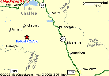
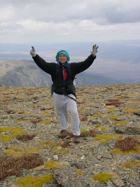
 Mount Belford (14,203 ft) and Mount Oxford (14,160 ft), Vicksburg, Colorado
Mount Belford (14,203 ft) and Mount Oxford (14,160 ft), Vicksburg, Colorado
 |
Journal of a Mad Hiker (Part 2, continued)
| Hike Stats | Date: September 7, 2002 | |
| Mount Belford: 14,203 feet | Base: 9,640 feet | Vertical Rise: 4,563 feet |
| Start: 06:45 | Summit: 10:00 | Return: 14:30 |
| Mount Oxford: 14,160 feet | Base: RT from Belford | Vertical Rise: ~1,400 feet |
| Start: 10:10 | Summit: 11:00 | Return: 12:15 |
| RT Dist: ~12 miles | Conditions: very windy, snow, rain | |
Well I knew my luck with the weather couldn't last forever, and boy did it run out on me in a big way today. I'd be tempted to call this the hike from hell, but it would have meant that hell has frozen over. It was COLD in the hills. I was literally blown away by this hike -- almost the entire day I hiked into a steady 40-50 mph wind. Besides making progress more difficult because I had to lean into the wind to avoid getting blown off the trail, the wind dampened the spirits and drained the will-power of even the most hardcore of hikers. As evidence, I even gave up my goal of bagging all three peaks today, something I had originally set my mind upon achieving before going home. Many a fellow hiker turned back early today too.
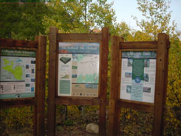
OK, quite a negative introduction to an otherwise awesome hike huh? Let me back up a little and cover the basics. Oxford, Belford, and Missouri can all be accessed via the Missouri Gulch Trail starting in the ghost town of Vicksburg. Named for Judge James D. Belford, the "Redheaded Rooster" of the Rockies who had a head of red hair and a flamboyant quick-witted personality, Mount Belford is the tallest of the three. Mount Oxford, obviously a member of the Collegiate Peaks, is adjacent to Belford and can be bagged via a mile-long connecting ridge. The Collegiate Peaks (Columbia, Harvard, Oxford, Princeton, and Yale) were named by famed surveyor and Harvard geology professor Josiah Dwight Whitney, who later became chief of the California State Geological Survey (Whitney Survey) and after whom the tallest peak in California and the lower 48 states is named. Lower in elevation and less ostentatious, Missouri Mountain, located on the opposite side of Missouri Gulch and separated from Belford by Elkhead Pass, was named by miners from the "Show-Me" state. When timed right and the weather cooperates, the tripple banger can be pulled off in one long day of about 15 miles and 7,000 feet in elevation gain.
The day started nicely as I reached the trailhead just before dawn. A fellow hiker from La Plata (one of the few I've met who have done all 54 fourteeners in Colorado) advised me a day prior that the easiest way to capture all three peaks is to start in reverse of the normal route -- bag Missouri first, then down its back side and come up to Elkhead Pass. From there, take the gradual ascent toward Belford but cut over toward Oxford before reaching its summit. Then return from Oxford, summit Belford, and descend via its steep northwest ridge. This route would avoid going up along the steepest part of the circuit. However, after studying the topo maps and gauging the weather, I was (justly) afraid that I may not be able to get all three peaks, in which case I would like to do at least two. Belford and Oxford seemed a better choice than Missouri and Belford, which were much further apart. So I set off toward Belford first.
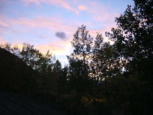
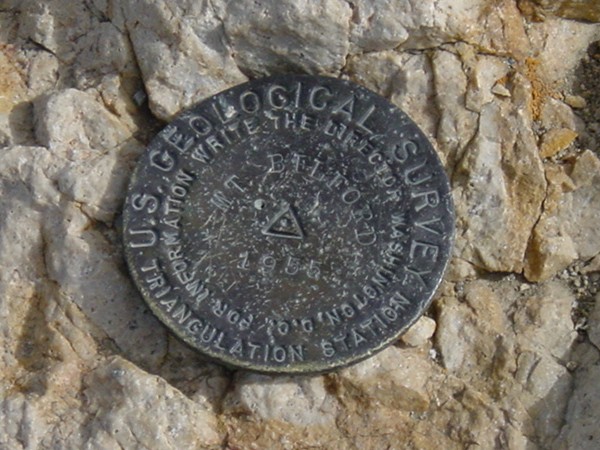
The Missouri Gulch Trailhead and forest area below treeline reminded me a lot of La Plata. Very scenic, lush and green. Patches of turning aspen lined the trail, and the early morning sun shone through the leaves and cast an occasional warming ray of light into the forest. However, as soon as I cleared about 12,000 feet and came out of the trees, the wind kicked up. And what a wind it was! The rest of the trail ascends the mountain in steep switchbacks and would have been equally impressive to me had it not been for the wind. On some gravelly portions of the trail, you'd have to be careful not to let the wind blow you off into the abyss. I donned my windbreaker, flared my hood, and pressed on, thinking as long as there's no lightning, I'm OK. The going got rougher and rougher as I came up on the summit ridge, but I was able to reach summit around 10 am.
By now the storm had started to build; coupled with the wind, I started to worry about my ability to finish the hike. I paused briefly to put on all the clothing I had (sweat pants, sweat shirt, windbreaker, hood, and gloves) and rushed off toward Oxford. The trough and ridge between the two peaks drop about 700 feet and makes a natural wind tunnel. Man, it was hard to keep my balance! An hour of hard-fought deliberate steps later, I came upon the large flat summit of Oxford. There were only two other hikers out there. Now the storm is in full force and coming right toward me. As I returned toward Belford, a light but freezing rain started to fall. 12:15, I returned back to the Belford ridge.
It was decision time. To press ahead toward Missouri or abandon ship and head back. Standing on the summit ridge of Belford and taking advantage of my visibility, I tried to gauge the storm's progress. The dark massive stormfront came toward me from the west, over the top of Missouri, and moved with surprising speed. I could see a patch of light behind it though, and being the eternal optimist, I thought the calm "eye of the storm" might come over Missouri when I made my way over there. So I decided to traverse a mile further, down toward Elkhead Pass (13,200 feet) where I would make another decision. From there, I could either go back down Missouri Gulch or go around the backside and climb up Missouri Mountain.
At Elkhead Pass, I sat and ate some lunch and pondered my predicament again. It is truly an amazing saddle location, and under any other circumstance, I would have enjoyed being there quite a bit more. To the north, I can look down Missouri Gulch back toward Vicksburg where my car awaits, the massive Mount Belford rises to my right and the jagged peak and ridge of Missouri Mountain to my left. Turning around, I can see the wide Missouri Basin open before me. A couple of small lakes 500 feet of elevation below my vantage point mark the spot where I must descend to and turn to climb up Missouri. I can clearly see the trail and traced it with my eyes over and over while mentally calculating the amount of work required. Let's see... 500 ft drop to the lakes, 500 ft gain back to 13,200, plus another 900 ft to the top of Missouri. Additional distance? About 2 miles. Time? About 100 minutes in this weather. Go? No go?
I now had to pull out one of my emergency ponchos as it started snowing and graupeling (another one of those words I had to learn the hard way) pretty hard. Graupel is frozen heavy snow that falls in small ice pellets short of full-on hail. I can hear the rumble of distant thunder as I fought the wind and pulled the poncho over my windbreaker. I kept thinking about that small patch of clear sky behind the storm, but being in a saddle, I could no longer see it. Did it close up? Or was it still there? Would I be able to make it up Missouri? Would I slip on the graupel, or worse yet get struck by lightning?
Another 5 minutes passed by, and the storm didn't get any better. I was also developing a stomach ache from eating too many granola bars and drinking freezing cold water. A decision had to be made. I bailed; the storm had won. Dejected and wet, I slung my pack over my shoulder and reluctantly walked homeward into Missouri Gulch. For a while, the rain got worse, and I was glad that I had abandoned the effort. About 45 minutes later though, that patch of clear sky moved overhead. I turned to look at Missouri, and it seemed to snicker at me. "Haha, you failed," the mountain said. I could do nothing but acknowledge its victory. For a moment or two, I wanted to turn around and go back up, to conquer that beast before going home. But the decision has already been made and implemented. I had descended too far. The rain had picked up again, and to go back now would be suicide. I'll get you another day, I promised! Still, I looked back every 10 minutes or so with longing glances and sighed... Back at the car at 14:30.
Thus my trip came to an unfulfilling end. The journey of the Mad Hiker (part 2) had concluded with only 10 fourteeners in 6 days of hiking. To tell the truth, I was going to do the triple banger and maybe hit one more in the Sangre de Cristo Range on the way home the next day. So instead of 12, I got only 10, and I was so disgusted with the outcome that I decided to make a mad dash home instead of staying another day on the road.
From Buena Vista, it was about a 12-hour drive back to Phoenix via the Four Corners region. I started immediately and averaged considerably higher than the posted speed limit (yes, I admit it). Save for a quick dinner at Denny's in Durango while hiding from a hellacious thunderstorm, the worst I've ever had the pleasure of driving through, and a quick fuel stop in Kayenta, I made great time. (Interesting side note: I had thought all of Arizona does not use daylight savings time during summer, but I found out after some confusion that the Navajo Nation in the NE corner does change their clocks. Hmm, learn something new everyday.) I coasted home through Flagstaff and Phoenix in a semitranced state of exhaustion and sleep-deprevation, and by 3:15 am, I was sound asleep in my own warm and comfortable bed, dreaming of Missouri Mountain. See you next year!
 |
 |
 |
 |
 |
 |
 |
| Prev | Next | Index |